Theodore
On top of the world
ROYS PEAK
AS GOOD AS IT LOOKS
The 1578m summit of Roys Peak Track in the Otago region of New Zealand’s South Island offers jaw-dropping panoramas over Lake Wanaka, Mt Aspiring and the Southern Alps, after a steep climb through meadows and grasslands on a 16km return loop. This being New Zealand, be warned that the track is closed for the lambing season, from October 1 to November 10 each year. Alpine gear is recommended in winter and sturdy windproof jackets year-round. But if you can get there… DO IT!!!
WHAT TO EXPECT ON THE ROYS PEAK TRACK
After arriving at the trail carpark, you’ll see a point to walk over a fence, which marks the start of the track. There is a donation box here that is optional but a great way to say thank you to the private landowners who have opened the trail to everybody.
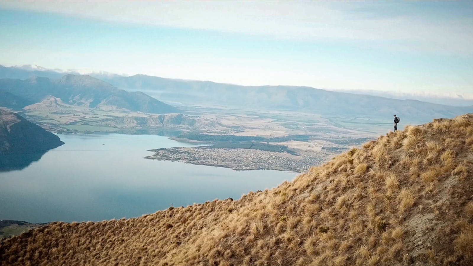
The start of the track gives you a good basis of expectations for what’s in store. Most of the hike continues on this wide, winding ascent up the side of the mountain, all the way to the Roys Peak summit.
Although the actual track tends to get monotonous, the views are a rewarding motivator. Stretching far out over Wanaka, the lake and far out to the distant peak of Mount Aspiring.
As the track climbs, you’ll notice the green grass giving way to duller, native alpine grass. In winter, there is usually also snow and ice on the trail, especially as you climb closer to the peak.
You might notice that there are sheep and cows that tend to share the track. This is a reminder that you are hiking on private property. I personally find it awesome that Kiwi’s are supportive of opening their land for everyone to enjoy!
After approximately 6KM of walking at approximately 1300M of elevation, you will have reached the famous Roys Peak lookout. There is a signpost at a small fork to the lookout, and beyond this, you’ll even find a toilet. The lookout point is a small ridge that continues out to the right, which makes for a great shot if you get a buddy to snap it from the slope just near the fork. The famous lookout view is arguably more impressive than the summit itself, which results in many people not continuing on.
However, after making it this far, it’d be a crime to turn around now!
THE “TRUE” SUMMIT
C’mon, with only another 1.5KM and less than 300M more elevation, you better be ready to pull up the bootstraps and keep going! The push to the Roys Peak summit from the lookout is very similar to the rest of the hike. The final section has an optional shortcut that follows the steep ridgeline. I followed this path on the way up as it was a little faster. I would imagine that this section would be very dangerous and difficult in winter. After finally reaching the Roys Peak summit, it was time for us to relax and enjoy the view. I hope the images do it justice, it truly is a once in a lifetime view and well worth the hike…
Roys Peak Distance: 16KM return
Hike Duration: 4-6 hours return
Elevation Gain: 1230M
Roys Peak Height: 1578M
Difficulty: Moderate